

Volume of a Stockpile Using 10 GCPs Vs No GCPs
Introduction:
The Main Question of this Video is: ‘Are Ground Control Points Required to Calculate the Volume of a Stockpile?’
At the most Basic Level, Ground Control Points are always required as they introduce the Element of Accuracy into a Survey.
However, the Debate still continues on whether Ground Control Points are a Necessary requirement for Stockpiles, or General Aerial Surveys of Small to Medium Size, particularly in the Mining and Resource Industry.
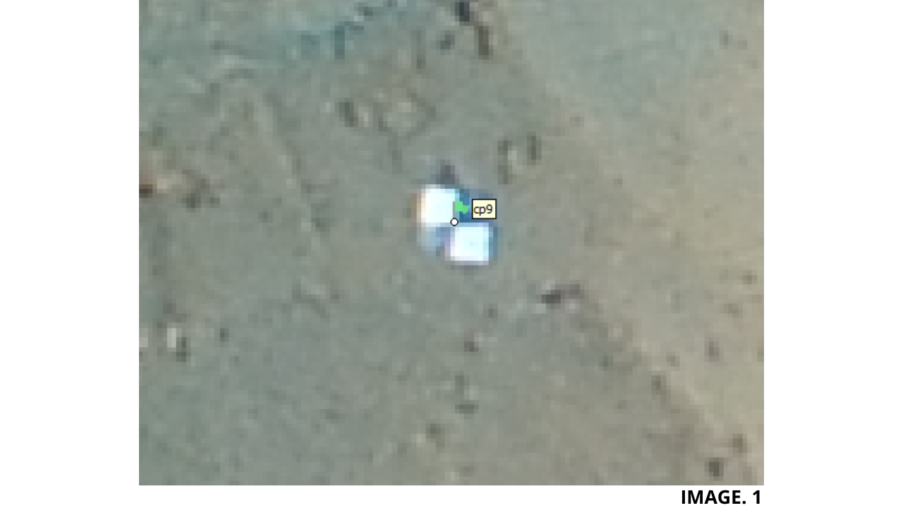
Image 1. Shows the Alignment of a Ground Control Point in Agisoft Metashape:
Debates concerning Stockpile Volume Calculations exist due to not just Economic and Safety Reasons, but, also are a Result of the Total Area being surveyed.
For Example, for an Area of less than 1KM, then, it is sometimes generally agreed upon, that the need for Ground Control is not required.
TIP: ‘Click Here to Read in More Detail About When and Where to Place GCPs.’
Therefore, do the Costs Outweigh the Benefits, in the Area being surveyed.
And can it be more Economical to Survey the Area using only an RTK Drone, if possible?
Practical:
This Video will compare the Volumes of 2 Typical Stockpiles, One with Ground Control Points and One Without, and also aim to add more Clarity on the GCP Debate as it relates to Stockpiles.
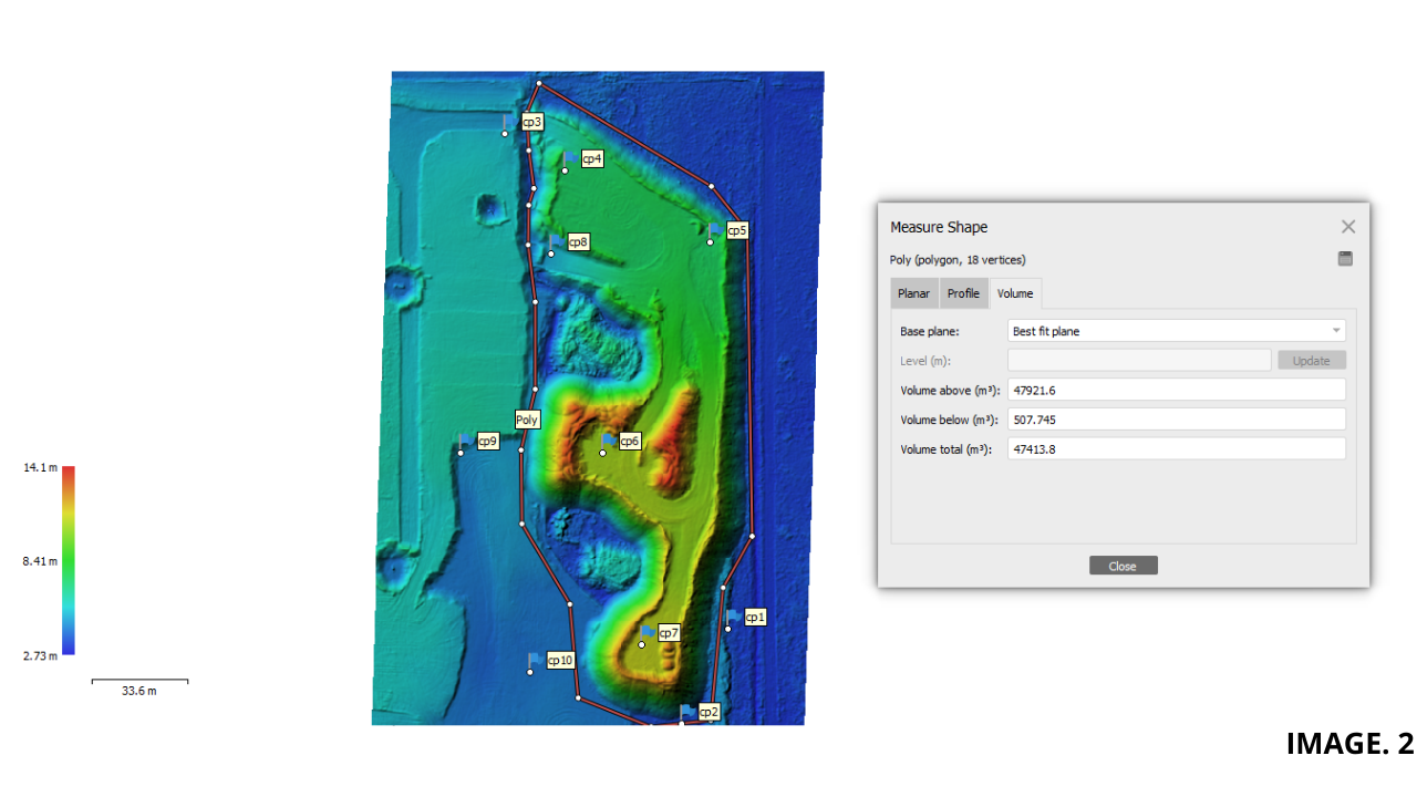
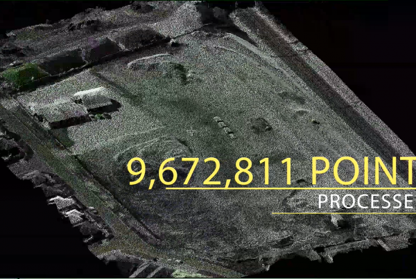
In the First Example we installed 10 Ground Control Points and lined each up to its correct Marker. Then, using an arbitrary outline, we find the Total Volume to be: 47413.8m³.
Image 2. Shows the Total Volume Calculation of a Stockpile using 10 GCPs:
For the next Example we will, keep as many things equal as possible. We can do this by renaming this file and removing everything after the Installation of Ground Control.
And so we will create the Dense Cloud and Digital Elevation Model again, but this time with no Ground Control Points.
TIP: ‘Click Here to Learn More About Dense Cloud Creation in Agisoft’.
As you can see, the New Dense Cloud has roughly the same amount of points created.
For the Volume Boundary calculation, we will use the same shape File.
And this time we can see that the Total Volume is: 47343.6m³.
This means that without Ground Control Points, the Volume total is 70.3m³ LESS.
As a Percentage (70.3 / 47413.8 = 0.00148) or 0.14% Difference.
Other Factors Affecting:
Stockpile Volume Survey Totals can also give varying results depending upon:
- Whether RTK is used or not.
- Time of Day, due to Moisture Content.
- What Altitude you are Flying at.
- What Processing Software you are using.
- Whether or not the Base Plane is differing and taken in to Account.
- Using a GNSS or Total Station as opposed to a UAV Survey.
Having taken all of the Factors Affecting into Account, it is still not Uncommon for the Total Stockpile Volumes to be all within around 5% of one another.
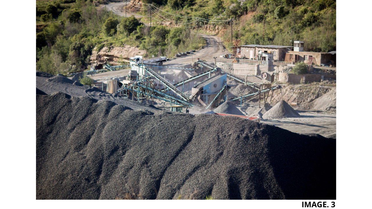
Image 3. Shows a Typical Stockpile on a Minesite:
As Ground Control Points provide good Elevation Accuracy, usually the Largest Differences in Volume Totals occur when the Horizontal Area is extended.
But, due to the Fact that Typical Stockpiles do not extend to Massive Areas, it can be concluded that, in General, Ground Controls Points in Stockpile Volume Calculation are Generally Not Required.
TIP: ‘Click Here to See a Stockpile Volume Calculation Without Ground Control Points’.
When is the Best Time to Use Ground Control Points?
In the most Basic Terms, Ground Control Points are Mainly Useful on Projects that require High Precision and High ABSOLUTE Accuracy.
Such Projects include, Land Title Surveys, Construction/Mine Site Inspections, New Proposed Road Planning, As-Built Surveys, Environmental Documentation and Overlaying Geo-Referenced Site Plans.
As a General Rule, Ground Control Points are not required for Projects that Only Require High RELATIVE Accuracy. Such Projects include; Measuring Lengths, Areas and Volumes, General Construction Site Management, Crop/Farm Scouting and Creating Marketing Material.
So without Ground Control Points, a Drone Map will still Achieve High Relative Accuracy. High Relative Accuracy is described as, ‘A measure of positional consistency between a data point and other, near data points. Relative accuracy compares the scaled distance of objects on a map with the same measured distance on the ground.’
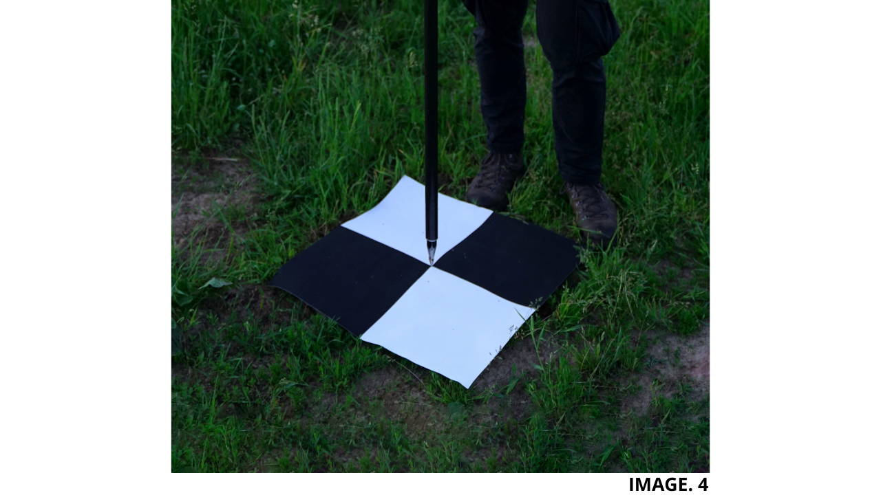
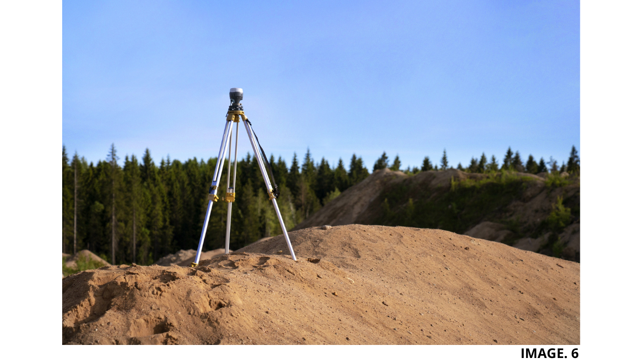
Image 4. Shows a Ground Control Point being RTK Established:
And with Ground Control Points, a Drone Map Project will Achieve High Absolute Accuracy. High Absolute Accuracy is described as, ‘The degree to which the position of an object on a map conforms to its correct location on the earth according to an accepted coordinate system.’
What Ratio of Ground Control Points do we need per Area?
In General, with all things being Equal, most Experts recommend placing a Minimum of 5 Ground Control Points for an Average Sized Project.
TIP: ‘Click Here to Learn More About GCP Ratios.’
More Accuracy is achieved with at least 10 Points and increasing up to 20 Points. However, other Experiments have shown that placing too many Points has been shown to introduce Diminishing Returns.
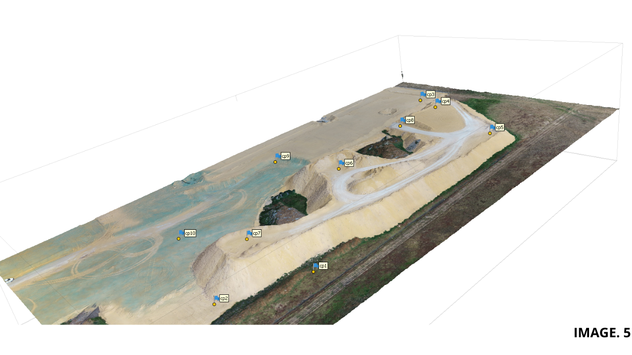
Image 5. Shows a Stockpile with 10 Correctly Placed GCPs:
And According to the American Society for Photogrammetry and Remote Sensing, recommends around 20 Checkpoints to Achieve 95% Accuracy of a Site, with 1 Ground Control Point per 2 Checkpoints.
And 1 Ground Control Point per 60 Images is recommended.
Other Distance GCP Ratios recommend 10 Ground Control Points per 10 Acres.
PPK vs RTK
With the Introduction RTK & PPK, the need for Ground Control Dramatically decreases. This is due to the Fact that RTK collects Real Time Satellite Data while connected to a Base Station, to give Absolute Positioning.
TIP: ‘Read More Here About PPK Vs RTK in More Detail.’
The debate still continues whether RTK Completely eliminates the need for Ground Control Points altogether.
RTK also has the Advantage of knowing the Precise Location of your UAV, if there is a Presence of High Winds.
One Main Advantage of Not having to place Ground Control Points is the Safety Aspect and also the Time Saving.
The Negatives of RTK include, the need to provide an immediate and constant Real-Time Connection and the Fact that RTK can be very expensive.
PPK, also can Eliminate the need for Ground Control placement. And also has the Advantage of not having to provide a Real Time Connection. PPK can also eliminate the need for a Base Station Setup, if there is Calibration Services running in the Area.
Image 6. Shows the Setup of an RTK Base Station:
The Disadvantage of PPK is that it requires Post Processing Operations, and can also be more Expensive.
The Future of Ground Control Points in Drone Mapping:
With the Increase in Technology making RTK & PPK Drones now cheaper than Ever, it is Predicted by some that the use of this Technology will soon become Industry Standard.
As we are constantly moving toward a more Automised World. The increased need for Dangerous and Time Consuming Manual Tasks is becoming Less and Less.
Andso it would appear that the Placement of Ground Control Points in the Future will Eventually be phased out, especially as we can Map out Larger Areas from Longer Distances Away.
TIP: ‘Click Here to See Our Other Video On Processing Point Clouds with No GCPs.’


Recent Comments