

Aerial Surveying the Natural World
What is Flora & Fauna Surveying?
One Area of Surveying in Particular which is not often talked about in the Field of Aerial Surveying is Flora & Fauna.
In a Nutshell, as we walk through a particular Location making a record of all of the Various Plant and Animal Species, we are actually carrying out a Flora and Fauna Survey.
The Survey includes collect detailed Data, which is then used to Map Trends and identify various impacts on an Ecological Area over a Period of time.
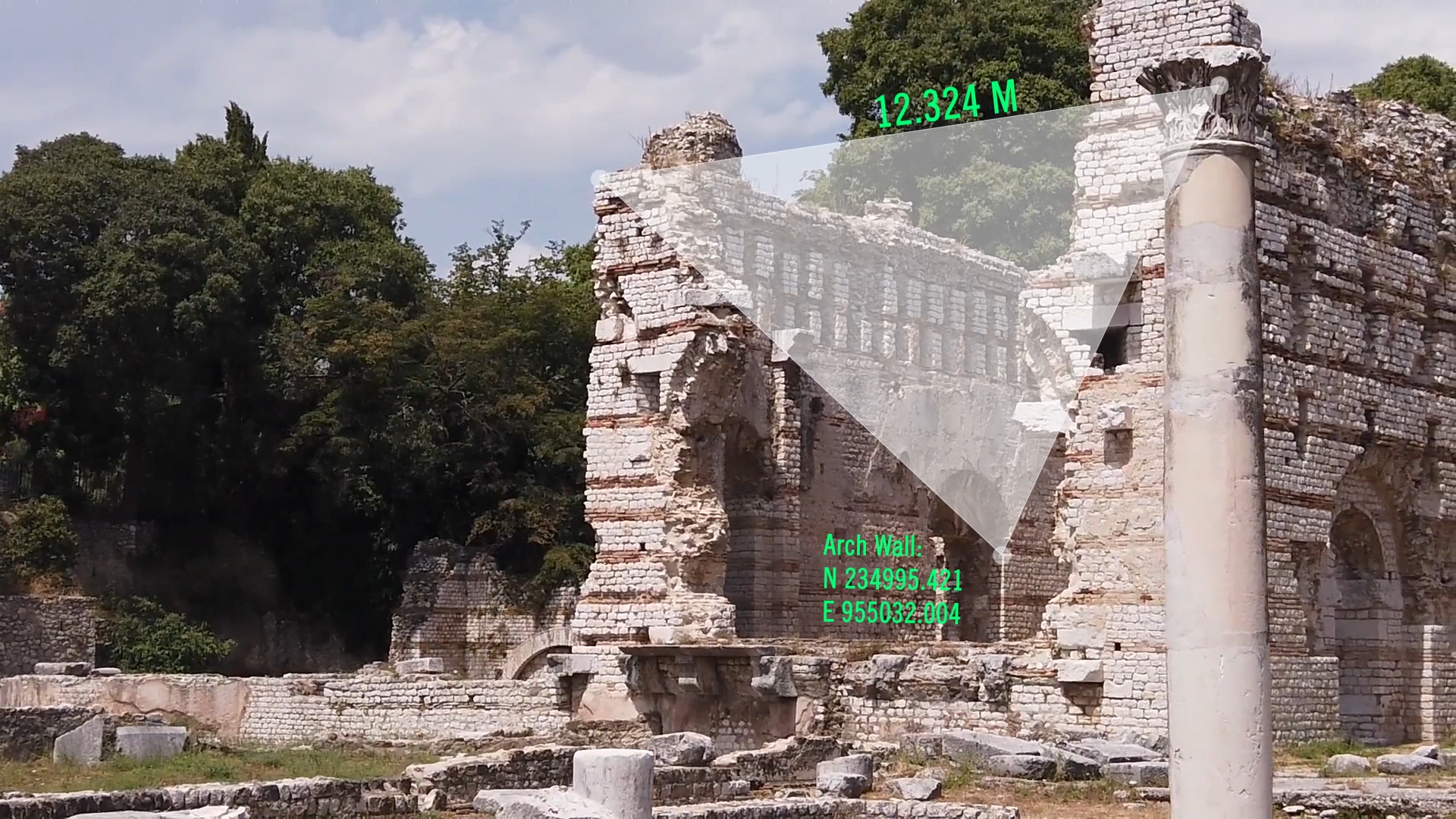
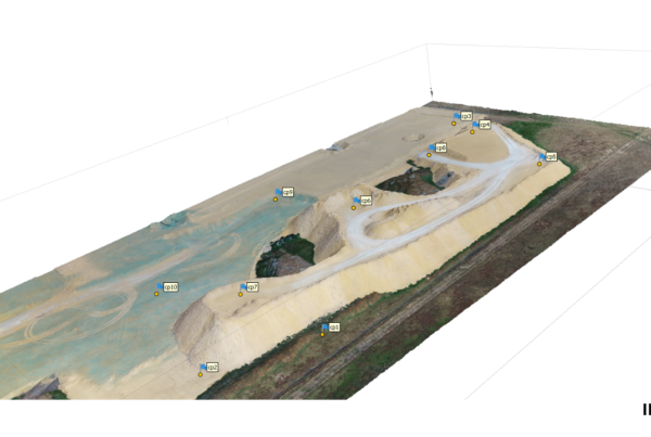
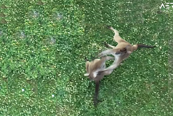
Image 1. Shows an Example of a Typical Fauna Survey Area:
Wildlife and Animals Movement over time can also be mapped and recorded in a Fauna Survey.
Why Carry Out Flora and Fauna Surveys?
To get a Good understanding of how a particular Species of Vegetation affects the Environment is probably the most important Factor of a Flora and Fauna Survey.
TIP: ‘Click Here to Find out More Detail about Flora Surveys’.
Also, the ability to identify the particular species in a particular area allows Surveyors to Map out and create Detailed Models, which can then further be used to evaluate the Importance of the Species to a particular Location on an International Scale.
Mapping in this way can also help identify other Invasive Species, to a particular Habitat.
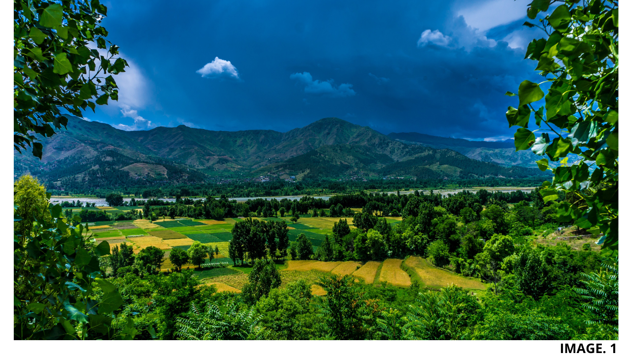
Image 2. Shows an Example of Typical Zebra Fauna:
Also understanding how different Species of Animals interact and best use certain Vegetation, allows for the implementation of better techniques that can prevent a declining population.
How Flora and Fauna Surveys are Carried Out?
As it is not Realistic to Count and Record Every Single Unit and Species or Flora and Fauna, it is Best Practice to Carry out Estimates of a Particular Population or Species by sampling them.
Flora and Fauna Surveys are usually carried out by Highly Experienced Botanists, who have been trained to understand how to best Sample, Analyse and Record a particular Species of Vegetation.
Image 3. Shows a Typical Botanist at Work:

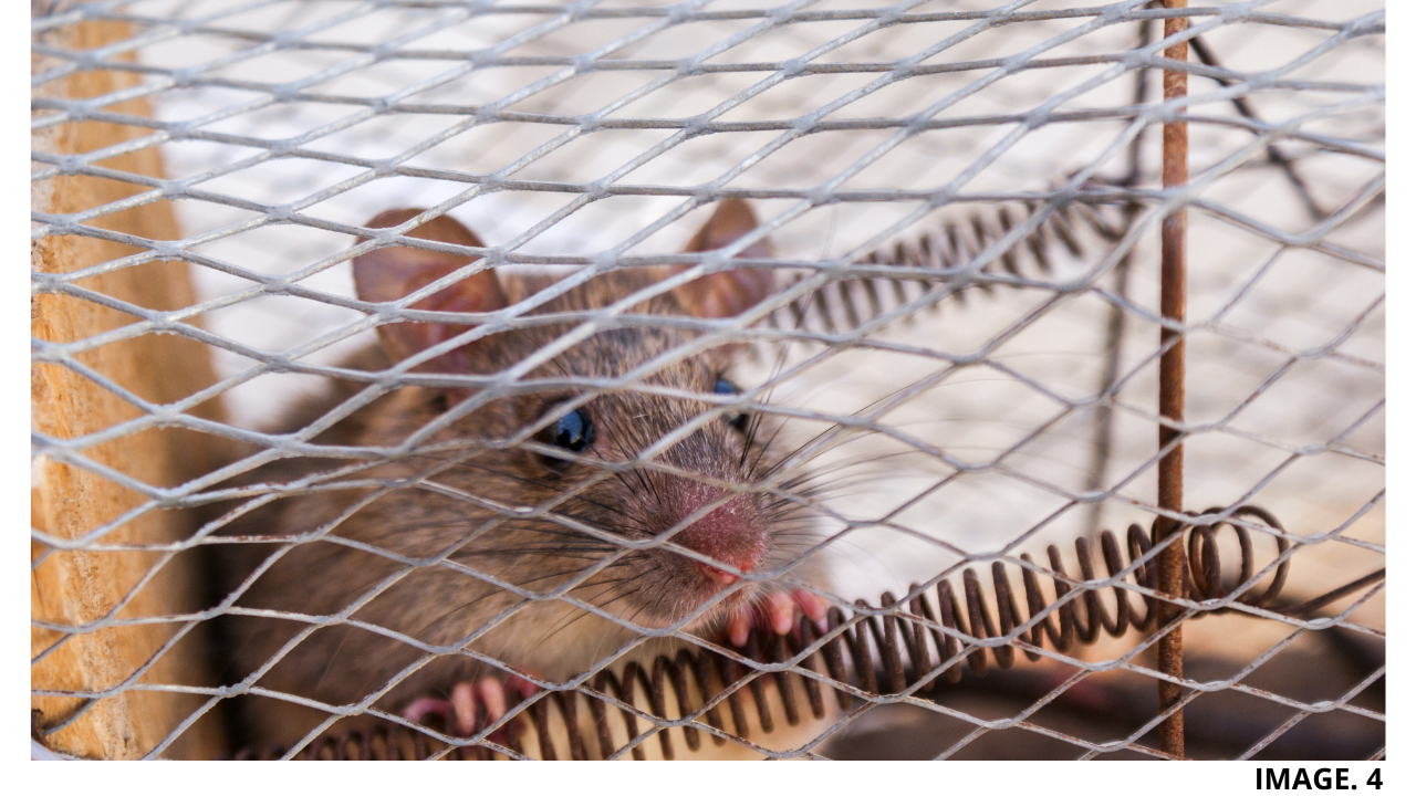
In the case of Fauna only Surveying, Traditionally this has involved the setting of Traps, such as pitfalls and cages, in order to capture various types of reptiles, amphibians or mammalian species.
Image 4. Shows a Typical Fauna Trap:
However, better Technology today allows for more improved methods, such as, Motion Sensor recording devices and Acoustic Recording Devices.
Where Does Aerial Surveying Come into Flora and Fauna Surveying?
In the case of Marine Conservation, the use of Drones has become very useful and time saving in Western Australia.
One Company is using Drone Technology to Map out Grids and Effectively Sight the Number of Dugongs of the waters of the Pilbara.
TIP: ‘Click Here to Find Out More About Using Drones for Fauna Surveys’.
There have been some limitations, but in general the use of Aerial Surveying Methods has allowed Surveys to be carried out over the same area several times, to see how a species distribution has changed over time.
Another Company in Africa has been using UAVs to Survey Ecosystems in the Savannah to Map out Zebra Populations.
In this Particular Example, a New Machine Learning System has been produced for the UAVs to Correctly Identify and Visualise the Zebra with a Red Box around each one. The Results have been very accurate, and this thus eliminates the need for Humans to Manually Count the Fauna.
Noted Advantages were, that the UAVs were much quieter than Traditional Aircraft, and so were less likely to disturb the Populations. Also, Safety Advantages were noted that the need for having Humans in planes flying over is totally eliminated.
What are other Types of Surveying the Natural World?
Other Types of Surveying the Natural World include, but not limited to, Geodetic, Hydrographic, Aerial and Topographic.
TIP: ‘Click Here to Learn More About Kangaroo Surveying’.
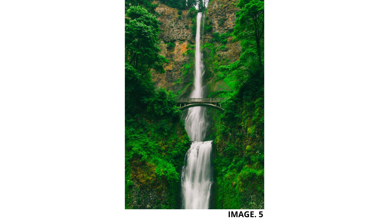
Image 5 Shows the Natural World:


Recent Comments